
Setting up your Garmin Edge 850 for Singapore’s Park Connector Network (PCN) requires a configuration that balances clear navigation, responsive tracking, and battery conservation. Because the PCN features a unique mix of dedicated cycling paths, shared pedestrian walkways, urban underpasses, and dense tropical foliage, standard road cycling settings can lead to constant auto-pause interruptions or missed turns. By customizing your map profiles, adjusting GPS tracking modes, and tailoring your data screens specifically for shared-path riding, you can ensure a seamless navigation experience across the island’s green corridors.
Pre-Ride Preparation and Basic Configuration
Before heading out onto the PCN, configuring the core system settings of your Garmin Edge 850 ensures the device behaves predictably under local conditions. Singapore’s tropical climate means outdoor rides often involve high temperatures and bright sunlight, which can rapidly drain battery life if your display settings are not optimized. Start by navigating to the system settings and adjusting the backlight brightness. Setting the backlight to auto-brightness or reducing the timeout duration to 15 or 30 seconds helps conserve power during long weekend rides spanning the Round Island Route.
Next, verify that your system units are set to the metric system. In Singapore, distance is measured in kilometers and speed in kilometers per hour, which aligns with the physical distance markers found along the PCN. Ensure your time format is set to the local time zone (UTC+8) so that your ride start times and sunset alerts are accurate. This is particularly useful for planning evening rides before the park lighting takes full effect.
Products mentioned in this guide
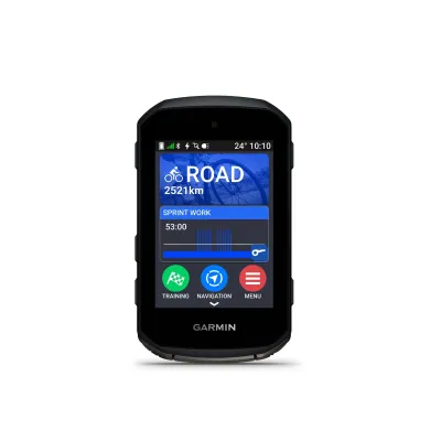
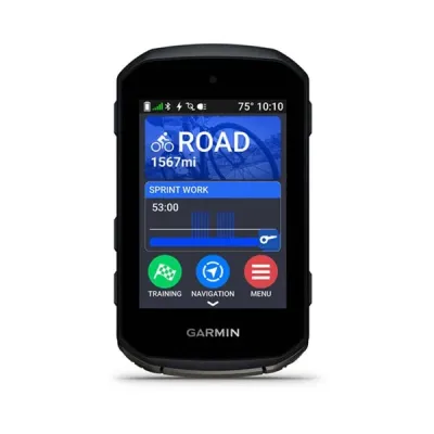
Prices are valid at publication and may change. Please refer to the product page for the latest price.
Pairing your external sensors is the final step of basic configuration. If you use a heart rate monitor, speed sensor, or cadence sensor, pair them using standard wireless protocols like ANT+ or Bluetooth. For PCN riding, a dedicated wheel-mounted speed sensor is highly recommended. Because the PCN passes under numerous concrete flyovers, MRT tracks, and dense tree canopies, GPS signals can occasionally degrade; a physical speed sensor ensures your speed and distance tracking remain continuous and accurate even when satellite reception is temporarily blocked.
Map Installation and Route Planning for PCN
Navigating the PCN successfully depends on having detailed, up-to-date local maps loaded onto your Garmin Edge 850. The device comes with preloaded regional maps, but you should verify that the Singapore region is fully updated before your ride. Connect your device to your smartphone via the official companion app to check for map updates. These updates ensure that newer park connectors, bridge crossings, and detours are correctly represented on your screen.

To follow a specific route, such as the Coast-to-Coast (C2C) Trail or the Eastern Coastal Loop, you can import custom GPX files. Many local cycling communities and official park planning portals offer downloadable GPX routes. Once downloaded to your smartphone or computer, these files can be imported directly into your companion app and synced to your device. This allows you to follow a highlighted path on your screen rather than relying solely on physical trail markers, which can sometimes be sparse at major urban intersections.
Adjusting your routing calculation preferences is critical for a smooth PCN experience. Within your activity profile, locate the routing settings and set the calculation method to prioritize cycling paths and avoid major expressways or restricted roads. Since bicycles are strictly prohibited on Singapore’s expressways, configuring these avoidance settings prevents the device from recalculating a route that directs you onto high-speed vehicular roads when you temporarily deviate from the park connector.
Customizing Data Screens for Urban Cycling
The data screens you use for open-road training are rarely ideal for the stop-and-start nature of PCN riding. When navigating shared paths, your primary focus should be on situational awareness, route adherence, and basic trip progress. Customize your main data screen to display a clean layout with four to five essential fields. Key metrics to include are current speed, elapsed distance, remaining battery percentage, and distance to the next turn. Having the next-turn distance clearly visible gives you ample warning to slow down before approaching sharp bends or transitions onto pedestrian bridges.
Tuning the auto-pause sensitivity is another crucial adjustment for urban cycling. On a standard road ride, you might set auto-pause to trigger the moment you stop. However, on the PCN, you will frequently encounter pedestrian crossings, traffic lights, and crowded park zones where your speed drops to a crawl. If your auto-pause threshold is set too high, the device will constantly beep and pause your activity while you are still slowly moving. Set the auto-pause feature to trigger only when you come to a complete stop, or consider disabling it entirely for highly congested routes to ensure your total elapsed time is recorded accurately.
Organize your device to use multiple, easily accessible data pages. Keep your primary navigation map on a separate page from your performance metrics. This allows you to swipe or scroll to the map screen when approaching complex junctions, while keeping your main screen focused on simple metrics like time of day and distance traveled. A dedicated system status page showing sensor connectivity and battery levels can be kept at the end of the carousel, keeping your active screens uncluttered.
Navigating and Managing Alerts on the Trail
Once you are on the trail, executing your planned route requires understanding how the Garmin Edge 850 communicates navigation prompts. When you initiate a saved course, the device provides on-screen turn indicators and distance-to-destination readouts. Pay close attention to the map screen as you approach major junctions, such as the transition points between East Coast Park and the Changi Airport Connector. The visual map overlay will show you exactly which fork to take, helping you avoid accidental detours onto pedestrian-only footpaths.
Enabling off-course and wrong-way alerts is highly beneficial for navigating the intricate web of the PCN. Because park connectors often run parallel to main roads or split into multiple local paths, it is easy to take a wrong turn. If you wander off the designated GPX route, the device will emit an audible alert and display a warning banner. If this happens, check the map screen to see your position relative to the highlighted route; usually, a quick U-turn or a short connection path will get you back on track without needing to restart the navigation.
Be prepared for temporary GPS signal degradation. Singapore’s urban landscape features high-rise residential blocks, deep underpasses, and heavy tree canopies that can obstruct satellite line-of-sight. If you notice your current speed fluctuating wildly or the map positioning lagging, do not panic. This is normal behavior when passing under massive concrete structures. If the device loses signal completely, continue riding along the clearly marked physical PCN path; the device will automatically recalibrate and reacquire the satellite signal once you emerge into an open area.
Post-Ride Syncing and Device Maintenance
Maintaining your Garmin Edge 850 after a ride is essential for preserving its longevity in Singapore’s humid, tropical environment. As soon as you finish your ride, save the activity on your device. If your smartphone is nearby and connected via Bluetooth, the ride data will automatically sync to your companion app. This allows you to review your route accuracy, speed consistency, and any paired sensor data immediately while enjoying a post-ride drink.
Physical maintenance is just as important as data syncing. Sweat, sunscreen, and road grime can accumulate on the device during a humid ride. Use a soft, damp microfiber cloth to wipe down the screen and the outer casing. Pay special attention to the charging contacts on the back of the device. Perspiration contains salts that can corrode metal contacts over time, leading to charging difficulties or connection issues. Gently clean the contacts with a dry cloth or an electronics-safe cleaning swab before plugging in the charging cable.
Finally, store your device in a cool, dry environment. Avoid leaving it in direct sunlight, inside a hot vehicle, or in a damp gear bag. High temperatures and persistent humidity can degrade the internal lithium-ion battery and compromise the weather-sealed gaskets. Storing the device in an air-conditioned room or a dry cabinet when not in use ensures it remains reliable and ready for your next PCN adventure.
Frequently Asked Questions (FAQ)
Can I use my smartphone to navigate if the device loses GPS signal?
Yes, your smartphone can serve as an effective backup navigation tool if your primary device experiences signal issues. You can open the companion app on your phone to view your saved routes and current location. If you choose to mount your phone to your handlebars as a temporary screen, ensure you use a secure, vibration-resistant mount designed for cycling. Keep in mind that continuous screen usage and GPS tracking will drain your phone’s battery quickly, so it is best used as a quick reference rather than a permanent display.
How do I update the firmware before a long ride?
To update your device’s firmware, connect it to your smartphone and open the companion app, or connect it to a computer using the official desktop synchronization software. The system will automatically check for available firmware updates and prompt you to install them. It is highly recommended to perform these updates at home using a stable Wi-Fi connection well before you plan to depart. Attempting to update the firmware right before a ride can lead to delays or incomplete installations if the connection is interrupted.
Community discussion
Share your experience or ask a question. Comments are reviewed before publication.